I was just barely able to make my first portable EME activation from DM56SS14HX at a campground named Quiet & Peaceful RV Park. I had driven from Weatherford, OK, leaving early in the afternoon of March 11th after having toured the Stafford Air & Space Museum and made it as far as a rest stop east of Albuquerque, NM, by late evening the 11th. I was trying to make it to near the Four Corners Monument area. I didn’t get into that area until mid-morning on Sunday, March 12th. I checked in to the RV Park and secured a space at the very westward end so as not to bother anyone with my very early morning activity. I was on the air for 902 EME at 08:00z Monday, March 13th.
I had been working with W5LUA and K5DOG in trying to figure out where it was legal to operate 902MHz EME with reasonable power. The limitations in New Mexico are many and seem severe in 47 C.F.R. § 2.106. There are a number of footnotes that limit 902-928 in New Mexico and nearby. Those footnotes specific to 902 MHz operations are:
- US267 In the band 902-928 MHz, amateur stations shall transmit only in the sub-bands 902-902.4, 902.6-904.3, 904.7-925.3, 925.7-927.3, and 927.7-928 MHz within the States of Colorado and Wyoming, bounded by the area of latitudes 39° N and 42° N and longitudes 103° W and 108° W.
- US275 The band 902-928 MHz is allocated on a secondary basis to the amateur service subject to not causing harmful interference to the operations of Federal stations authorized in this band or to Location and Monitoring Service (LMS) systems. Stations in the amateur service must tolerate any interference from the operations of industrial, scientific, and medical (ISM) devices, LMS systems, and the operations of Federal stations authorized in this band. Further, the amateur service is prohibited in those portions of Texas and New Mexico bounded on the south by latitude 31° 41′ North, on the east by longitude 104° 11′ West, and on the north by latitude 34° 30′ North, and on the west by longitude 107° 30′ West; in addition, outside this area but within 150 miles of these boundaries of White Sands Missile Range the service is restricted to a maximum transmitter peak envelope power output of 50 watts.
The last sentence in US275 is the tough nut to crack. This limits operation from not at all on 902-928 MHz or to <=50w PEP depending on location. Here is a graphic I worked up to show the exclusion zone in white and the 50w PEP limit areas inside the black lines:
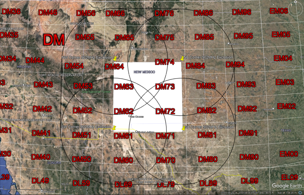
I have these entered into Google Earth Pro on my logging laptop. If anyone wants an export of these points, please send me an email as listed on QRZ.com.
The approximate distance from the nearest 50w limit circle boundary to the RV park was a bit more than 13 miles. It seems a bit close, but there were very few other choices. I needed a place where I could connect to AC mains as my generator seems to make enough electrical noise to mask 902 MHz EME signals.
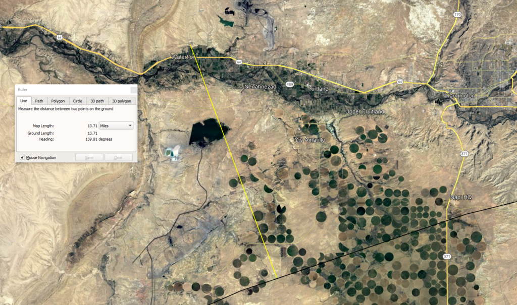
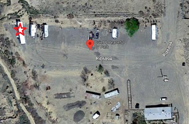
Closer to the four corners would also work, but this campground seemed like the best choice in terms of angles, trees, camper spots, and cost.
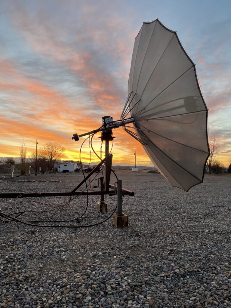
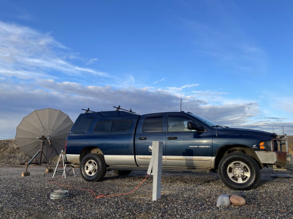
This was my first solo activation in the field. The RV park had no toilets or showers. I had to plan my activity carefully. I posted to the 902 MHz EME reflector on groups.io late in the afternoon that I would be on the next morning. I estimated that I needed 20 degrees elevation before I would have moon. It turned out that I only needed 10 degrees, but I used the extra time to get the dish better aligned to the moon. With better planning and more confidence from experience, I should be able to give everyone more lead time for my activations. My operating location looked like:
In all, 4 stations were logged. W5LUA, AC0RA, K0DAS and K5DOG completed with me.
Thank you to everyone that worked me or helped me. I was very tired and cold by the time I was finished. The overnight low was 31F and there was frost on the back of the truck. I slept in the back seat of the truck with a space heater powered from the AC mains, but it was not quite enough to keep the truck cab warm. I did not run the engine overnight as it seemed the RV park was focused on “quiet”. If I had a proper RV, I would have been much more comfortable. With as much effort as I had to put in, I made the decision to press onward toward the Utah/Nevada border. I had to stop in Salt Lake City the next day to chase down tire chains to fit the oversize tires on my truck to stay legal for the mountain passes in Oregon. I wanted to try to put UT/NV on from the Wendover and West Wendover area, but the morning I would have been the weather forecast included rain and 40mph wind gusts.
The original reason for me to drive from Georgia to Oregon was to visit my parents for an extended stay of more than a month. I will be getting on to 902 and 1296 EME from Oregon during this stay. I will make sure to choose better moon declination days while I am in Oregon. I will plan for some activations in May as I make my way back to Georgia.